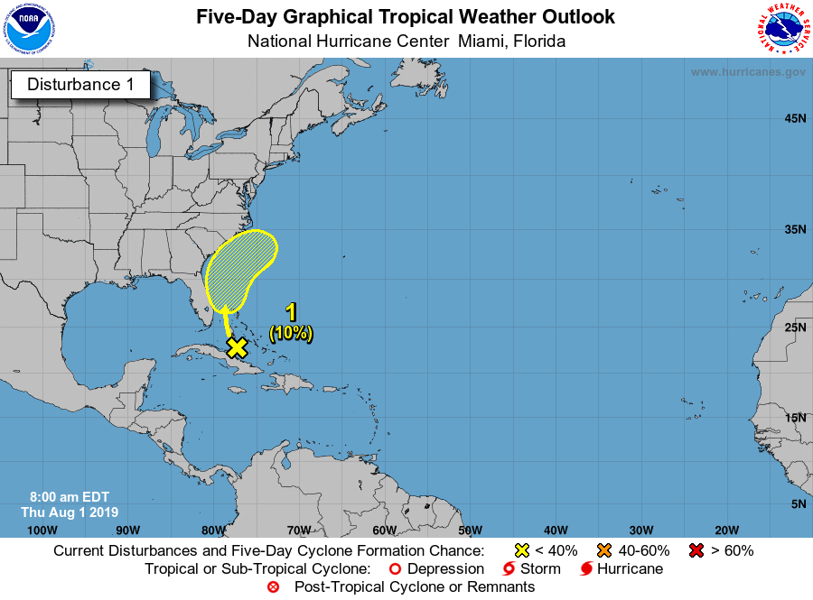
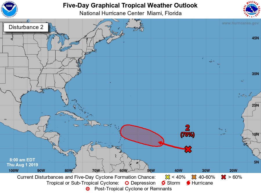
It’s like clockwork every year once August arrives. That usually means the National Hurricane Center’s tracking begins to fill up with yellow, orange, and red circles. This year is no different, as there are a couple of areas of interest to keep an eye on currently. Let talk about the first and less concerning area below first.

This is the area designated as “Invest 95” by the NHC. Here is what the NHC is saying about it this afternoon:
“An area of disturbed weather located near the northwestern Bahamas is forecast to move northward, producing locally heavy rainfall over portions of Cuba, the Bahamas, and Florida during the next day or two. Conditions could briefly become marginally conducive for development over the weekend before the system merges with a front and accelerates northeastward off the southeastern U.S. coast on Sunday.”
With that said, they only have the chances of this becoming a depression or storm at 10% over the next 5 days. It’s something to keep an eye on.
However, there is something out there to keep an even closer eye on over the next several days.

Invest 96 still well out in the Atlantic has a good chance of forming over the next 5 days. This one looks like it will be one that has to be monitored closely. Models indicate a westward movement, and then an eventual turn more to the northwest and north. But, as usual, the question in the long term will be when it will make the turn and how close to land it will be when it finally does. The long term future of this system is still up in the air, but this will be the one to watch.
Here is what the NHC is saying about this wave:
“A broad low pressure system located about 1000 miles west-southwest of the Cabo Verde Islands continues to produce a large area of disorganized showers and thunderstorms. Only gradual development of this system is expected for the next day or so while it moves west-northwestward at 10-15 mph. Environmental conditions could become more supportive by Saturday and a tropical depression is likely to form over the weekend several hundred miles east of the Lesser Antilles.”
Stay tuned for several more updates over the next week.
